32 Earthquakes Just Hit the Youngest Volcanic Field in the United States — And Almost Nobody Knows It Exists
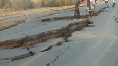
On April nineteenth, two thousand and twenty six, at five forty-five in the morning, seismographs across southern Millard County in the state of Utah began registering something unusual. Within hours, at least thirty-two earthquakes had occurred in rapid succession, without a single dominant mainshock — no large event followed by progressively smaller aftershocks. Instead, the tremors arrived like a sustained cluster of small but persistent jolts, each releasing a portion of accumulated energy across a wide fault zone. The largest reached magnitude three point six at eight forty-three in the morning. No injuries were reported, no significant damage occurred. But the location of this swarm is what makes it remarkable, because those earthquakes happened right beside the youngest volcanic field in the state of Utah — a system where the last known eruption took place approximately six hundred and sixty years ago, and where the subsurface magmatic plumbing is still considered active.
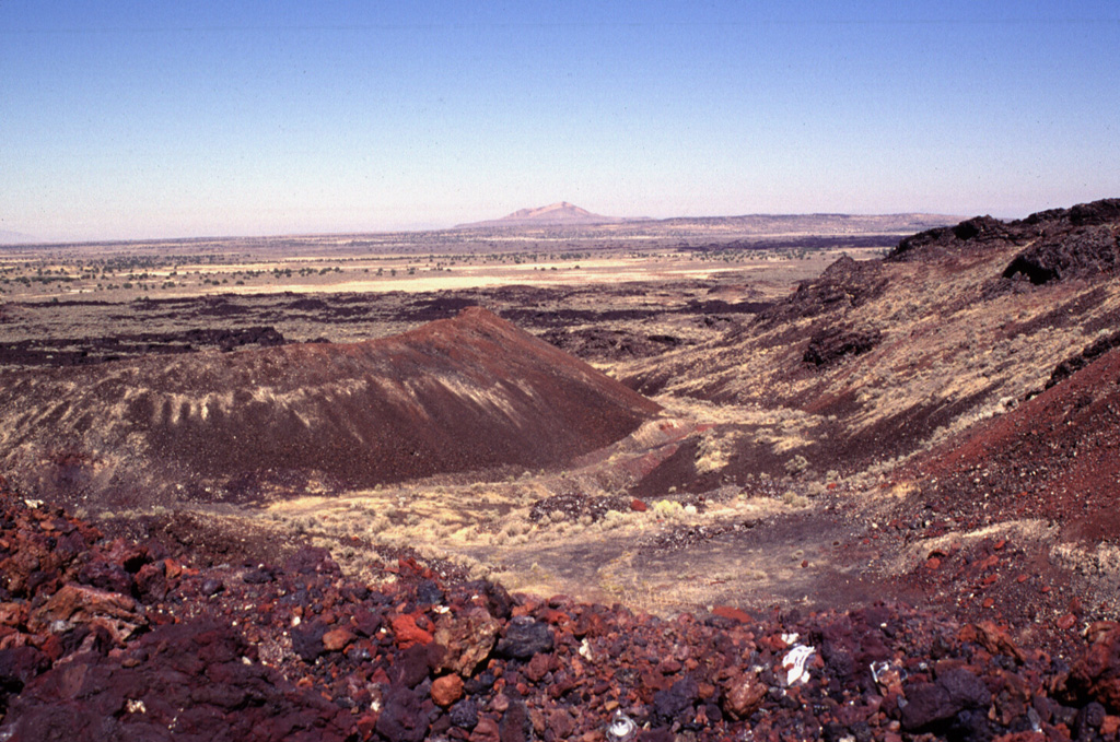
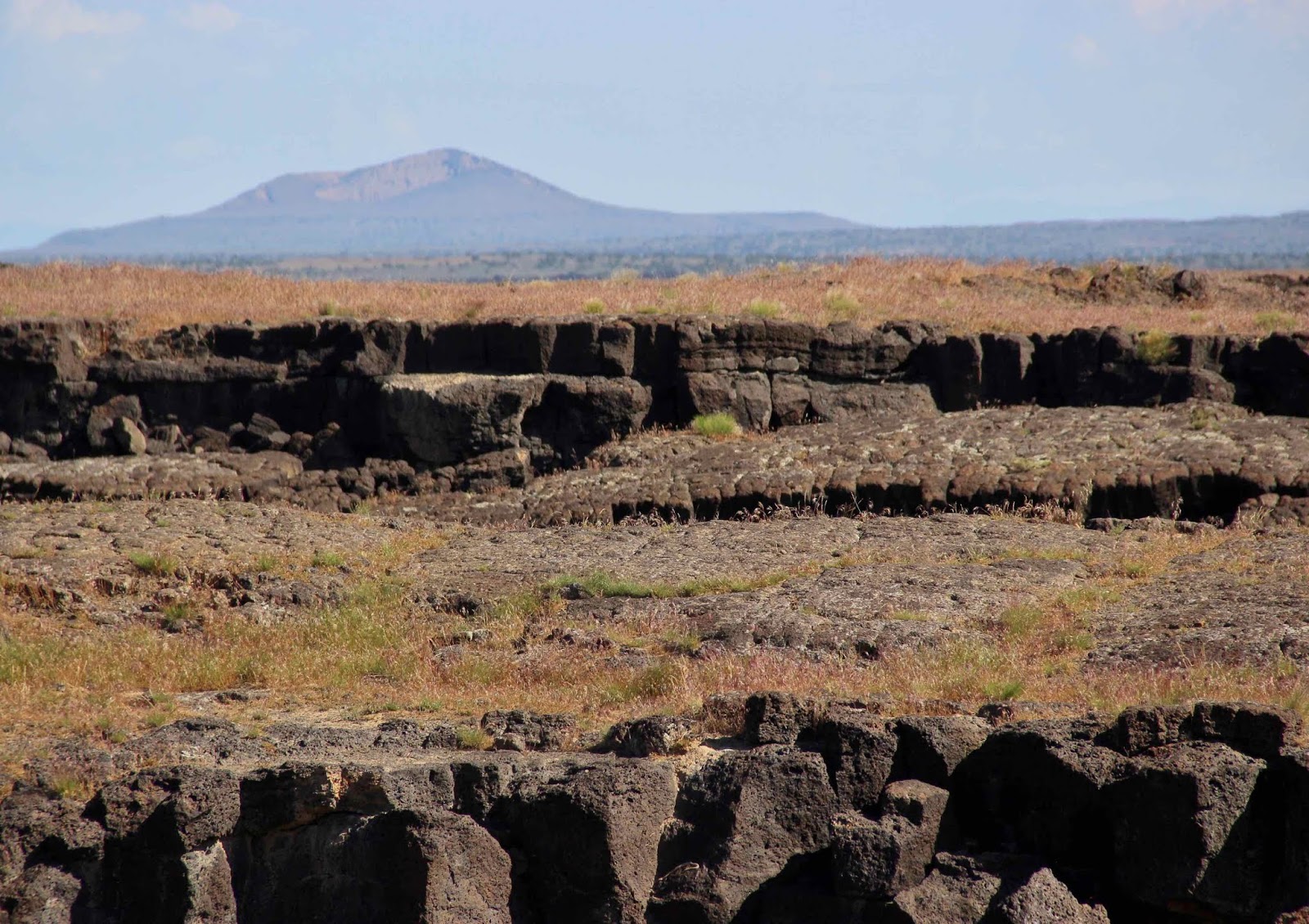
The Black Rock Desert Volcanic Field covers an area of nearly seven thousand square kilometers in west-central Utah, positioned between the towns of Cove Fort and Delta. It has been geologically active for more than six million years, with continuous volcanic behavior documented for the last two point seven million years. The field consists of six distinct sub-fields: Deseret, Pavant, Kanosh, Tabernacle, Ice Springs, and Cove Fort. Each hosts different volcanic structures, including cinder cones, tuff cones, lava domes, maars — explosion craters formed when rising magma contacts groundwater — and extensive basaltic lava flows in both pahoehoe and aa forms. The Pavant Butte tuff cone, which stands two hundred and seventy meters high, erupted approximately sixteen thousand years ago directly into the waters of prehistoric Lake Bonneville, which covered much of the Great Salt Lake Basin at that time. The waterline marks carved by those ancient waves are still visible on the cone’s flanks today.
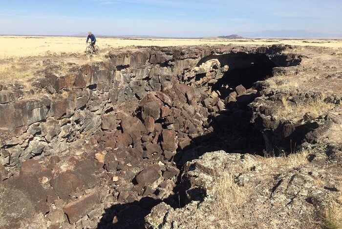
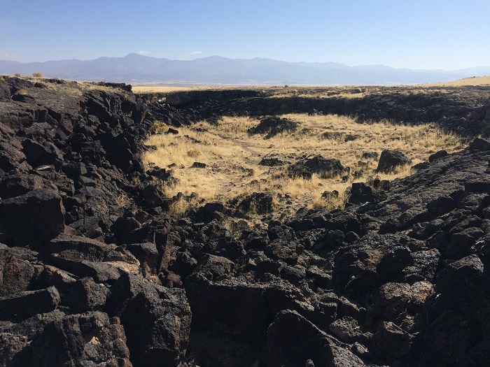
The most intriguing component of this volcanic system is the Ice Springs sub-field, which contains the youngest confirmed eruptive vent in Utah. Radiocarbon dating of root fragments found beneath the lava flows produced an age of six hundred and sixty years, with a margin of error of one hundred and seventy years. That means that when European navigators were crossing the Atlantic and major American civilizations were flourishing, there was an active volcano erupting in what is now the state of Utah. The Ice Springs field contains three large maars: Crescent at five hundred meters in diameter, Miter at three hundred meters, and Terrace, a collapsed crater also three hundred meters across. Lava flows from the main vent complex traveled approximately four kilometers to the west and north, overlapping older flows from the Pavant Butte system. The Black Rock Volcano itself — part of the Kanosh sub-field and situated roughly fifteen miles south of Fillmore — rises more than ninety meters above the valley floor between Interstate fifteen and the town of Kanosh, directly in the area where the April two thousand and twenty six swarm occurred.
What likely triggered the swarm? The Utah Geological Survey and University of Utah seismologists explain that the region sits along what is called the Intermountain Seismic Belt, a zone of active seismicity that runs down the spine of Utah along the eastern margin of the Basin and Range Province. In this province, the Earth’s crust is being stretched in an east-west direction, thinning the crust and causing it to break and slip along faults in the process. That tectonic extension also allows more heat to rise from the Earth’s interior, which is part of why young volcanism occurred in this region in the first place. But the proximity of the April swarm to the volcanic field adds a second possible explanation: fluid migration. Beneath the Black Rock Desert system, geothermally heated water and gases such as carbon dioxide move through microscopic fractures in the rock. When these fluids encounter fault zones, they act as a lubricant, causing small fault segments to slip and generating the kind of clustered, diffuse seismicity that characterizes volcanic earthquake swarms. This mechanism is fundamentally different from the stress buildup and sudden release that generates a major tectonic earthquake, which is why swarms like this one rarely produce events above magnitude four.
What does this mean in practical terms for the people of Utah and for anyone interested in volcanic risk in the continental United States? The Utah Geological Survey was direct: the April two thousand and twenty six swarm is not evidence of an imminent eruption in the Black Rock Desert. The system is classified by the USGS with moderate volcanic threat, and its long repose period combined with its remote location means immediate risk is very low. However, events like this one are important reminders that active volcanic fields exist across the American West in places that receive far less scientific attention and public awareness than Yellowstone or the Cascade volcanoes. Research following two earlier earthquake sequences in the Black Rock Desert, in two thousand and eighteen and two thousand and nineteen, found that those swarms had seismic characteristics significantly different from conventional tectonic earthquakes in Utah — leading University of Utah seismologists to recommend expanded monitoring of the area. The April two thousand and twenty six swarm revives that recommendation. Below the Utah desert, fluids are moving, faults are responding, and the underground architecture of a volcanic system that last built lava flows six centuries ago is still functioning as a connected, dynamic geological system. The seismographs caught it. Most people missed it entirely.