At 8,530 feet above sea level, on the border between Germany and Austria, a mountain is quietly tearing itself apart. And scientists monitoring it have stopped asking whether it will collapse. They are only asking when.
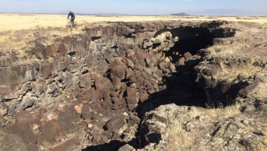
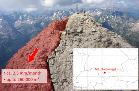
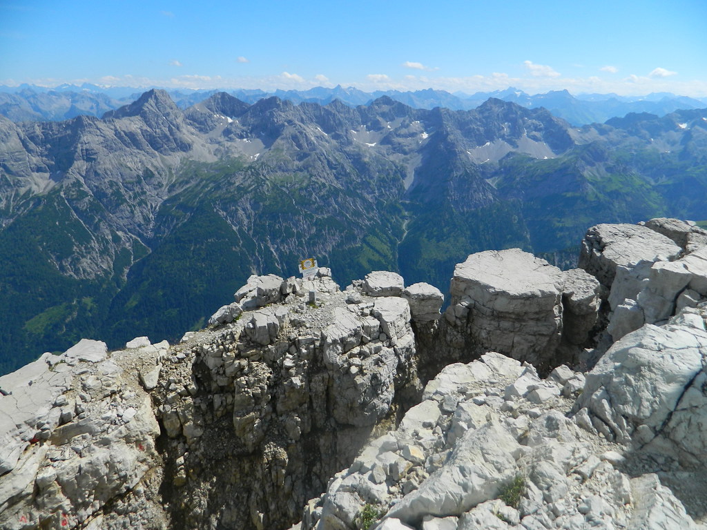
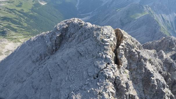
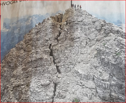
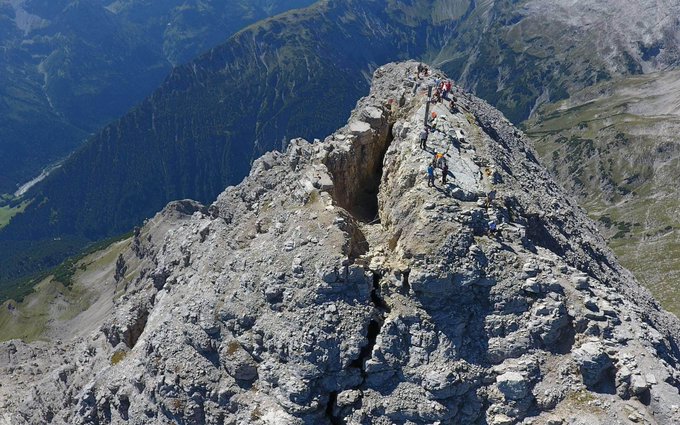
The Hochvogel is a peak in the Allgäu Alps — a dramatic limestone and dolomite massif that has attracted hikers and climbers for generations. But somewhere near its summit, hidden from casual view, a crack has been growing for more than a century. It is 130 feet deep, 115 feet long, and 20 feet wide. It expands at a rate of 2.5 millimeters every month. It has never stopped.
The crack was first documented in the late 1800s. Since then, it has been measured, studied, and monitored with increasing urgency. What researchers have found is not reassuring. An estimated 140,000 cubic meters of rock have already broken away from the mountain over time. What remains inside the unstable zone — still perched at altitude, still shifting — is approximately 260,000 cubic meters of dolomite. That is roughly the equivalent of 100,000 fully loaded dump trucks worth of rock, suspended above the valleys below.
Geologists have classified the remaining mass as acutely unstable. That phrase carries real scientific weight. It does not mean the mountain might collapse. It means the conditions for collapse are already present. The only unknown is timing.
So what is actually happening inside the Hochvogel?
The mechanism behind the crack is a process geologists call deep-seated gravitational slope deformation — a slow, continuous failure of a mountain’s internal structure under its own weight. Unlike a sudden landslide triggered by a storm or an earthquake, this type of collapse builds over decades or centuries. The rock does not fall all at once. It creeps. It fractures. It opens joints. It shifts incrementally until the point where internal stresses exceed the strength of the material holding it together.
In the Hochvogel’s case, the dolomite rock that makes up the summit zone is particularly vulnerable. Dolomite is strong when intact but fractures along predictable planes under sustained stress. The crack visible near the summit is not an isolated fissure — it is the surface expression of a much deeper failure that extends well into the mountain’s interior. The 130-foot depth of the crack is a direct measurement of how far that internal fracturing has already progressed.
Water plays a critical role in accelerating the process. Every winter, snowmelt and rainwater seep into the crack and into the surrounding rock joints. When temperatures drop, that water freezes and expands, widening the fractures by fractions of a millimeter at a time. Over decades, those fractions add up. Freeze-thaw cycling is one of the most powerful mechanical forces acting on alpine rock faces, and the Hochvogel sits at an elevation where those cycles happen repeatedly every year.
Climate change is adding another layer of concern. As permafrost — the permanently frozen ground that acts as a kind of natural cement in high-altitude rock — thaws at higher elevations than in previous centuries, the structural integrity of mountain slopes across the Alps is being compromised in ways that were not present even fifty years ago. Researchers studying alpine rock instability have documented an increase in rockfall frequency across the region, and the Hochvogel is considered one of the most closely watched sites on the continent.
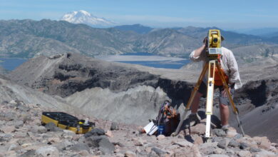
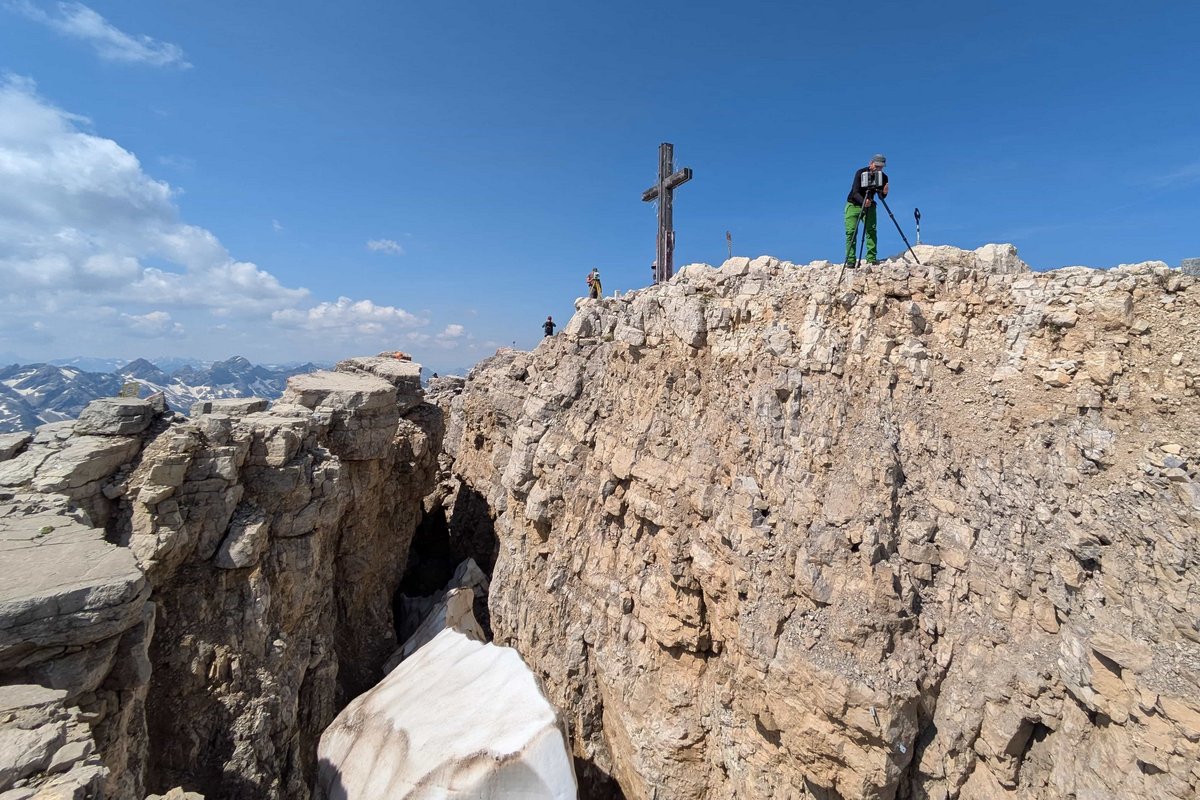
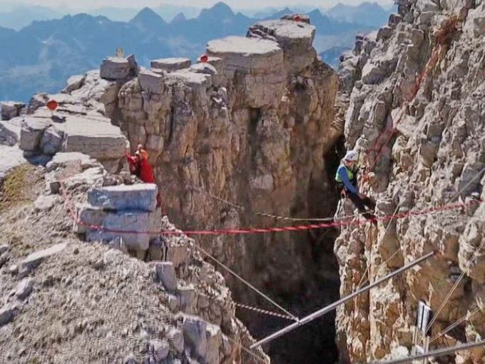
A monitoring network installed on the peak tracks movement in near real time. Sensors measure displacement, crack width, and seismic activity. The data is transmitted continuously to research teams who are building predictive models to estimate when the collapse threshold might be reached. The challenge is that even with precise instrumentation, the exact moment of failure in a system like this is extremely difficult to predict. Rock behaves nonlinearly. A slope can remain stable for years while stresses build invisibly, then transition to rapid movement within hours or days.
What happens when 260,000 cubic meters of rock finally gives way?
The consequences would depend heavily on the direction and velocity of the collapse. The Hochvogel sits in a region with valleys, hiking trails, and infrastructure below. A large-scale rock avalanche from that elevation would travel fast — much faster than most people expect. Dry rock avalanches at alpine scale can reach speeds exceeding 100 kilometers per hour, and the material does not slow down easily once it is in motion. The energy involved in a collapse of this magnitude is comparable to a significant explosive event.
This is not a hypothetical confined to academic papers. The Hochvogel has been included in regional emergency planning discussions in both Germany and Austria. Authorities are aware. The populations in the valleys below are not unaware. And scientists continue to publish, monitor, and refine their estimates — not because they expect to predict the exact date, but because the data gives emergency responders the best possible chance of acting when early warning signals begin to accelerate.
The broader story here goes well beyond one peak in the Allgäu.
Hundreds of mountains across the Alps, the Andes, the Himalayas, and other major ranges are experiencing similar dynamics. As global temperatures continue to rise and permafrost continues to retreat, the stability of high-altitude terrain is changing on a timescale that is visible within a single human lifetime. The Hochvogel is exceptional in that it has been documented and monitored for so long. Most mountains with comparable internal fracturing are not monitored at all.
What makes the Hochvogel crack so significant scientifically is precisely that long record. More than 125 years of documented growth provides researchers with a dataset that simply does not exist for most other unstable slopes. That data allows them to identify acceleration trends, seasonal patterns, and long-term behavior that would be invisible in shorter observation windows. In a field where prediction is one of the hardest problems, that historical record is extraordinarily valuable.
The mountain is not going anywhere overnight. The crack has been growing at 2.5 millimeters per month for generations. But 2.5 millimeters per month, sustained over time, is not nothing. It is a system that is moving continuously toward a threshold. And the researchers who have devoted their careers to understanding it are not relaxed. They are watching carefully, publishing urgently, and working with emergency planners to ensure that when the signals change — when the rate of movement accelerates, when the crack widens faster than the models predict — there will be a plan in place.
For now, the Hochvogel stands. Fractured. Monitored. Slowly pulling itself apart at the seams — 2.5 millimeters at a time.