The ground under Naples is still rising. The instruments are still running. And the math is not yet giving a different answer.
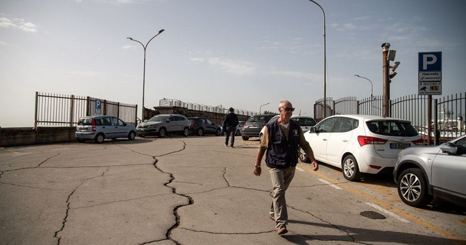
A magnitude 4.1 earthquake struck the coastline near Bacoli, Italy, on May 21, 2026. For most of the world, it was a footnote. For the scientific community monitoring Campi Flegrei, it was one more data point in a sequence that, according to a study published three weeks earlier, may be converging toward something with no clear historical precedent.
The April 2026 pre-print study, submitted to arXiv by Davide Zaccagnino and colleagues, applies a mathematical model called a regularized finite-time singularity to more than two decades of GPS ground deformation data and seismic records at Campi Flegrei. The result is a critical time window — approximately 2030 to 2034, with a midpoint of 2033 — not as an eruption forecast, but as the projected arrival of a mechanical threshold that the caldera’s crust, under sustained and accelerating pressure, may be approaching for the first time in the modern observational record.
Understanding what that means requires understanding what Campi Flegrei is — and what it has been.
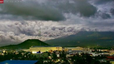
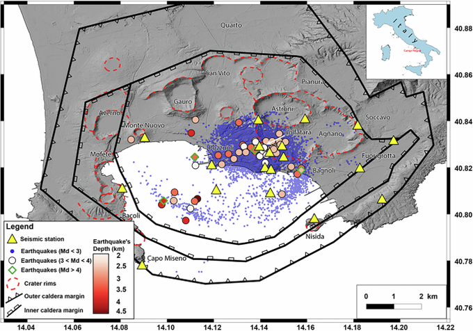
The Phlegraean Fields, as the caldera is sometimes called in English, sit twelve kilometers west of Naples. The name comes from the Greek for burning fields, and the description was never metaphorical. The landscape smells of sulfur. Steam rises from vents in the ground. The harbor at Pozzuoli — the largest city within the caldera, home to roughly eighty thousand people — requires periodic dredging because the seafloor keeps rising. Today, more than five hundred thousand people live inside the caldera itself. Naples, with three million residents, sits within the potential impact range of a large eruption. Campi Flegrei is, by any measure of population exposure, the most densely inhabited volcanic caldera on Earth.
The geological process that defines daily life here has a name that locals use without drama: bradyseism. From the Greek for slow earthquake, bradyseism refers to the episodic uplift and subsidence of the caldera floor driven by volcanic gases and magmatic fluids moving through the rock below. As pressure builds beneath the surface, the ground rises. When it redistributes or releases, the ground can fall again. The cycle can span years or decades.
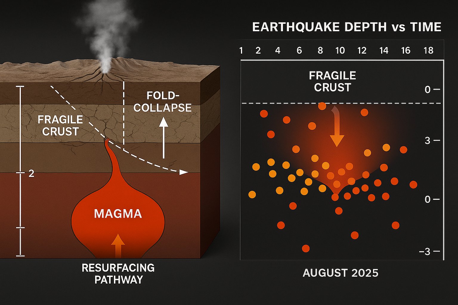
Three major bradyseismic crises occurred at Campi Flegrei during the twentieth century. In the late 1950s, the ground in Pozzuoli rose approximately one hundred and seventy centimeters, forcing a partial relocation of residents from the historic center. Between 1969 and 1972, a second episode produced similar uplift. The most serious crisis, from 1982 to 1984, raised the ground by one hundred and eighty centimeters, generated thousands of earthquakes, and forced the complete evacuation of approximately forty thousand residents from the Rione Terra district. Many never returned. After 1984, the system quieted. Ground slowly subsided. Earthquake counts dropped. Scientists described Campi Flegrei as a restless but manageable system — one that vented pressure periodically without reaching eruption.
Those twentieth-century crises were driven primarily by hydrothermal fluids: water heated by relatively shallow magmatic processes beneath the caldera. There were precedents. Models existed. The behavior, while disruptive, fit within a recognizable pattern.
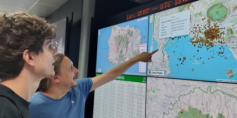
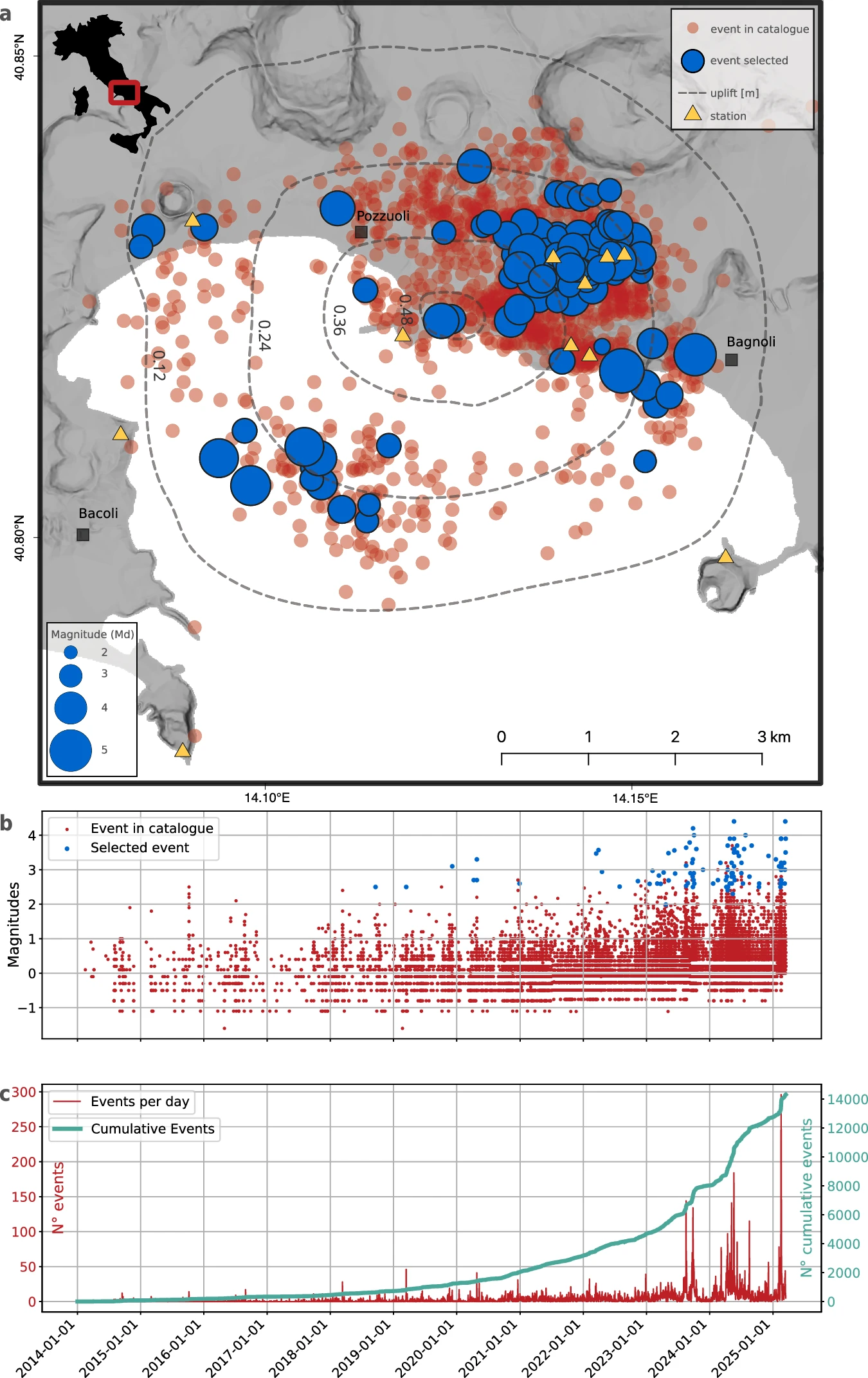
The current unrest episode, which began in 2005, looked familiar at first. Then it continued without stabilizing. Then it accelerated. As of 2026, the caldera floor has risen roughly one hundred and forty centimeters since 2005 — approaching the total of the entire 1982-1984 crisis — and the ground is still rising at ten millimeters per month. The magnitude 4.6 earthquake of June 30, 2025, was the strongest event at Campi Flegrei in decades. In a single week spanning late February and early March 2026, the monitoring network registered seventy earthquakes. The Italian Civil Protection maintains the alert at yellow — the second of four levels — but the system’s behavior has, according to the April 2026 study, moved beyond what the yellow-alert parameters were calibrated to describe.
The core question the model asks is simple even if the math isn’t: is Campi Flegrei accelerating down an infinite road, or toward a wall? Exponential growth can, in theory, continue indefinitely. A finite-time singularity cannot: it converges on a specific moment, after which the system must transform. When the researchers fitted both models to the Campi Flegrei data, the singularity model performed significantly better. They ran independent analyses on the GPS deformation data and the seismic energy data. Both converged on the same critical window: 2030 to 2034. Not the infinite road. The wall.
The paper is explicit about what the model does and does not predict. It does not predict a specific eruption. It predicts a mechanical threshold — a point at which the caldera’s behavior is expected to change regime. After the threshold, multiple outcomes remain possible: a major eruption, a prolonged period of intense seismicity without eruption, or significant new fracturing and gas release along pathways that do not currently exist. The model cannot distinguish between these outcomes. What it establishes is that the system is heading toward a transition, and that the transition has no analogue in the observational record since systematic monitoring began.
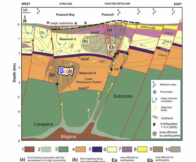
A second key finding concerns the source of the current unrest. Previous bradyseismic crises were primarily hydrothermal — driven by secondary fluid processes at relatively shallow depths. The current episode shows geochemical signatures consistent with deep magmatic volatile input: gases from the magma body itself are pressurizing the rock above. The distinction is practical: a hydrothermal source is like a leaky pipe — it runs until the reservoir empties and then it stops. A deep magmatic source is more like a pressurized tank being continuously refilled from below. The pressure doesn’t stop because the source doesn’t stop. That source is the volcano’s own internal evolution, and it doesn’t operate on the same timeline as the hydrothermal crises of the twentieth century.
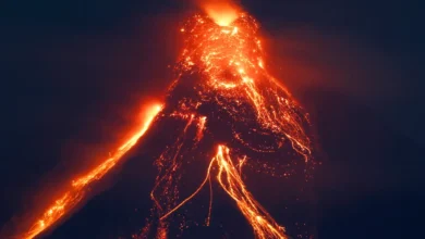
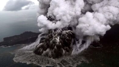
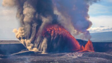
The eruption scenario at Campi Flegrei has been studied in rigorous detail. Pyroclastic flows at speeds exceeding two hundred kilometers per hour, an ash column that would ground aviation across southern Europe, agricultural disruption across Italy and neighboring countries, and the displacement of several hundred thousand people within hours. Italy’s Civil Protection maintains a detailed evacuation plan and conducts regular drills. The monitoring network, operated by INGV’s Osservatorio Vesuviano, is one of the most advanced volcanic surveillance systems in the world.
What the April 2026 study raises, less visibly, is a different kind of concern. All of the existing tools — the hazard models, the evacuation plans, the alert-level criteria — were built on what Campi Flegrei has done in the past. If the current trajectory leads somewhere that has no precedent in the observational record, those tools face a question they were not designed to answer: how do you manage a system entering unknown behavior in real time?
The Campanian Ignimbrite eruption, thirty-nine thousand years ago, deposited volcanic material across a geographic range stretching from western Europe to the Black Sea. Its climate signal appears in Greenland ice cores. The current crisis is not projected to produce an event of that magnitude. But the historical context of what Campi Flegrei has been capable of belongs in any honest assessment of what a regime change in this system might ultimately mean.
Giovanni Macedonio, director of the INGV institute in Naples, stated in November 2025 that the two strongest recent earthquakes at Campi Flegrei were the most powerful his institute had ever recorded there. That is not speculation about future risk. That is observed reality. The system has already done something outside its modern record. The 2030-2034 window is the mathematical extrapolation of where the current trajectory leads if sustained.
Seven years. Long enough for more data, better models, and revised projections. The system may behave differently than the current trajectory suggests. Science leaves room for that. But the convergence of two independent datasets toward the same critical window, the geochemical evidence of deep magmatic input, and the clear departure from twentieth-century bradyseismic dynamics collectively point toward a system that has entered a phase its own history does not fully describ