Mount Dukono Erupted Today. Three people lost their lives. The Volcano Had Been Warning For Thirty-Nine Days.
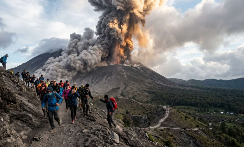
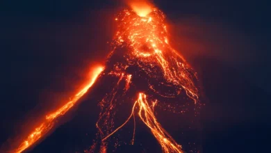
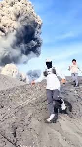
At 7:41 AM local time on May 8, 2026, Mount Dukono in Indonesia’s North Maluku province produced its most violent eruption in years, sending an ash column 10 kilometers (about 6 miles) into the sky. Twenty climbers were inside the official 4-kilometer exclusion zone when the explosion happened. Three did not come back down. The geological monitoring agency had been publishing warnings about this exact escalation for over five weeks.
What Happened This Morning
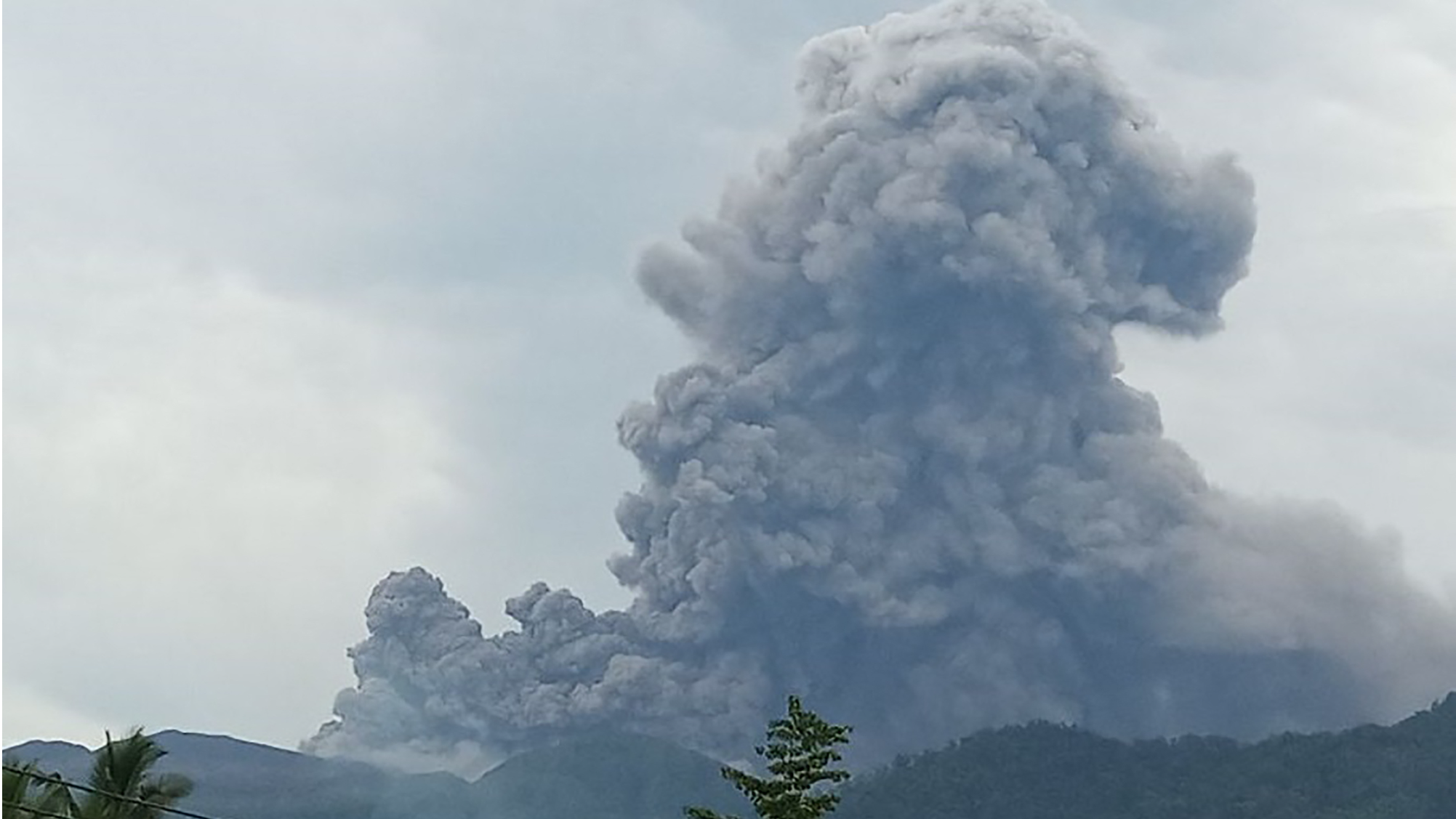
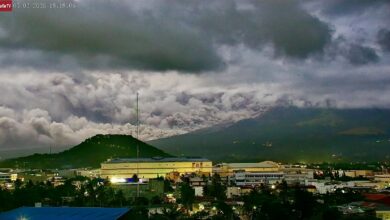
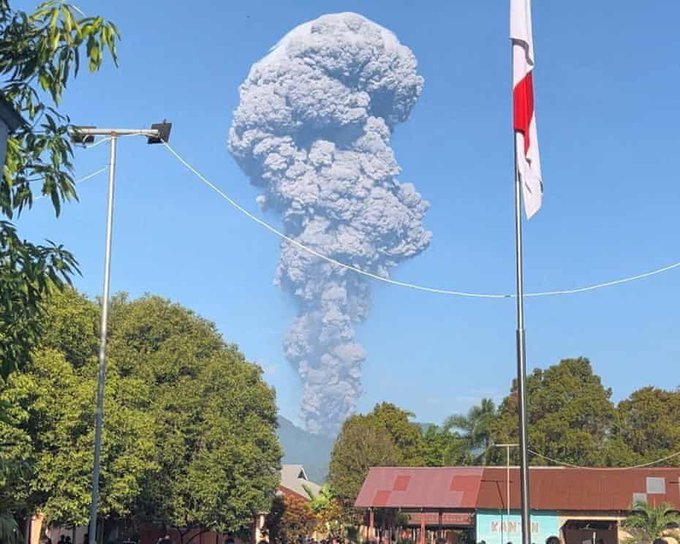
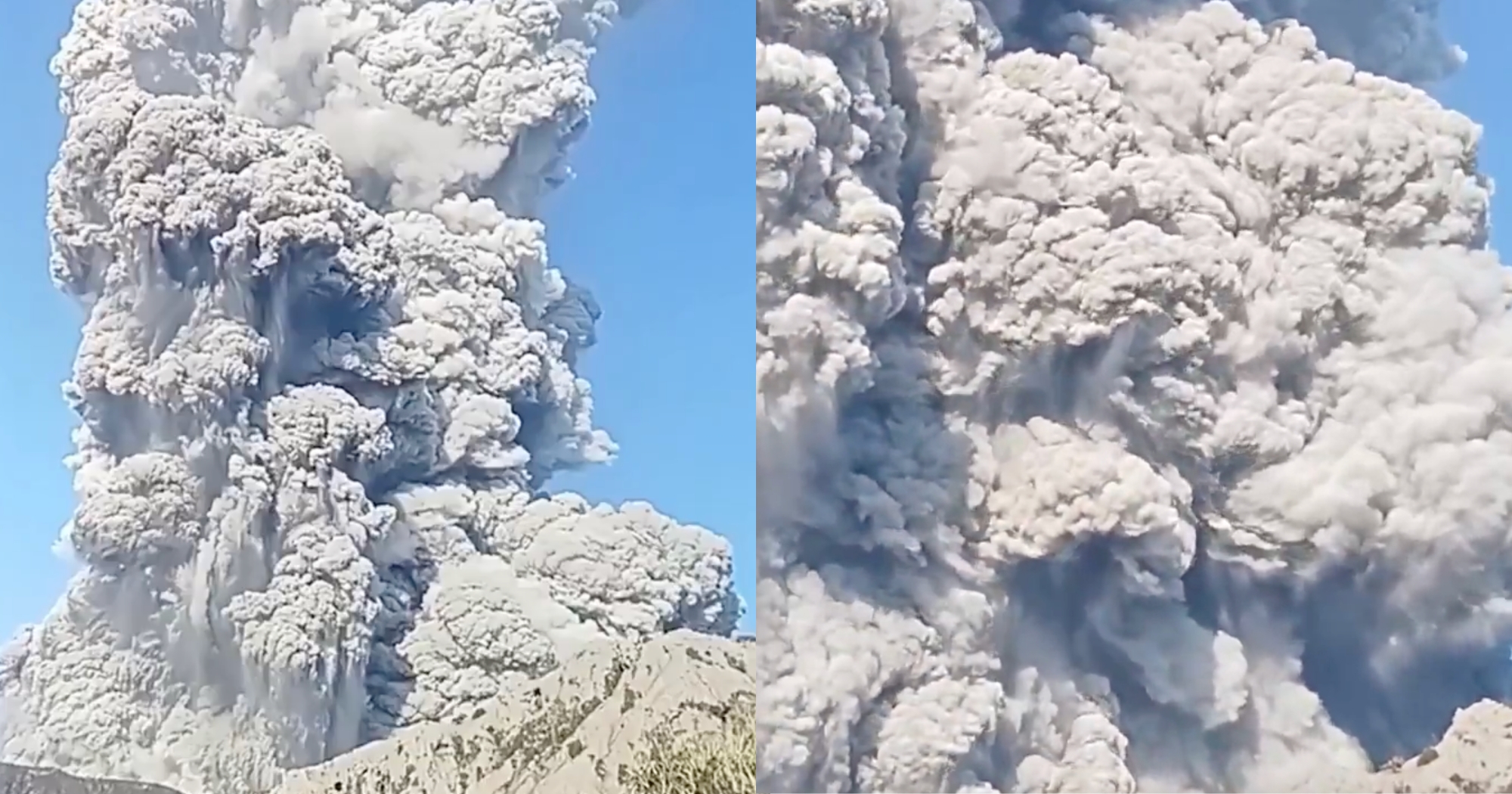
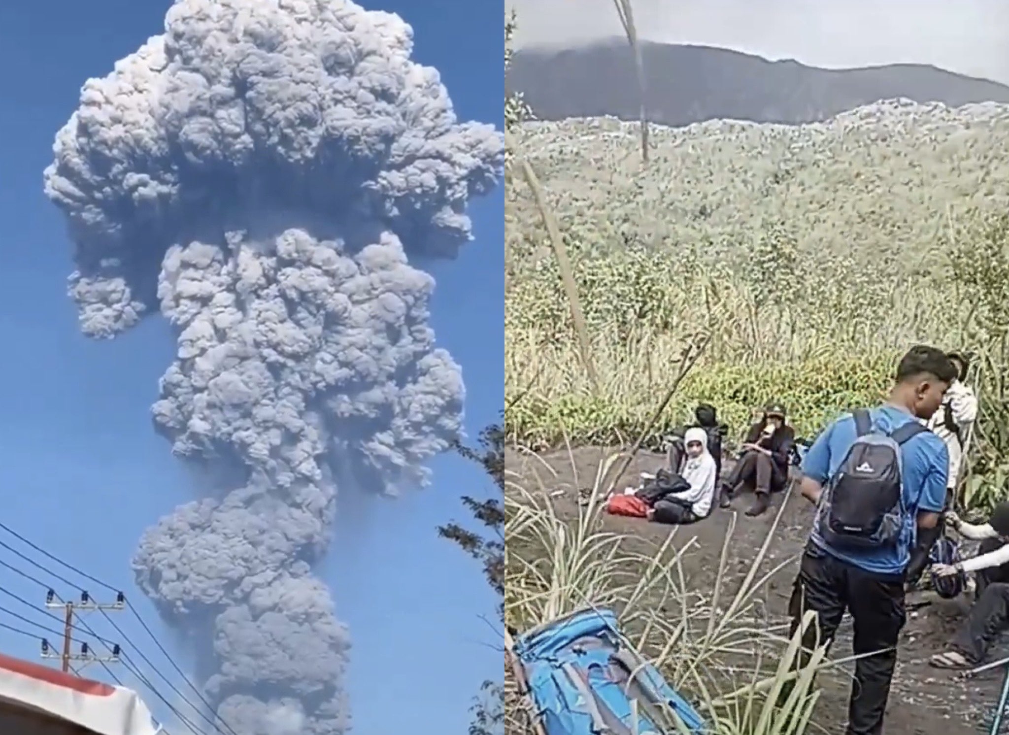
The eruption began at 7:41 AM Eastern Indonesia Time on Friday, May 8. According to the Indonesian Center for Volcanology and Geological Hazard Mitigation (PVMBG), the ash column rose 10,000 meters above the summit, drifting north toward the city of Tobelo. The plume was thick, ranging from white to grey to black. Witnesses described a supersonic boom audible for kilometers around the mountain. The seismic network recorded 42 eruption earthquakes during the day, with amplitudes between 6 and 20 mm and durations up to 64 seconds. The eruption was still ongoing as of the time PVMBG published its update.
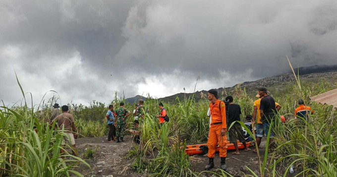
Twenty climbers were on the mountain at the time of the eruption. Nine were foreign tourists, including two Singaporean nationals. Eleven were local hikers. They were guided by a tour operator and a porter. By Friday afternoon, fifteen climbers had been safely brought down. Two remained unaccounted for. The bodies of three who did not survive remained on the slopes, because rescue teams could not safely approach the crater rim while the eruption continued. The search operation was suspended for Friday and is set to resume Saturday, depending on volcanic activity.
The Thirty-Nine-Day Warning
The eruption that happened today was not sudden. It was the climax of an escalation pattern that PVMBG had been documenting since March 30, when the seismic network around Dukono logged 199 explosive events in a single day. That marked the end of a quieter phase that had begun in August 2025. From March 30 onward, daily ash plumes climbed steadily, reaching up to 2,000 meters above the summit by the first week of May. Mount Dukono erupted seven times in the seven days before today.
PVMBG had been issuing public warnings about the volcano since December 2024, asking tourists and climbers to stay at least 4 kilometers (2.4 miles) from the Malupang Warirang crater. After the March 30 escalation, the agency formally closed the area to all visitors on April 17. The alert level for Mount Dukono had been at Level II (on a scale of I to IV) for over a year.
Local tour guide Alex Djangu, who survived because he stayed in the safe radius with two German hikers, told reporters something that captures the geology of what happened. The volcano had gone unusually quiet in the days before the eruption. Djangu, who has guided climbers up Dukono for years, said it was the quietest he had ever seen the mountain. He warned his guests that a major eruption was building, because the volcano was holding pressure at the base of its crater instead of venting it gradually. His prediction was correct within hours.
The Geology Behind the Pattern
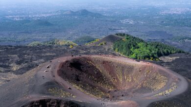
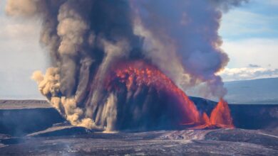
Mount Dukono is what volcanologists call a persistently active volcano. It has been erupting continuously since 1933. That is over ninety years of unbroken activity. Most active volcanoes go through cycles of eruption and rest, with months or years between events. Dukono almost never rests. Small ash plumes rising 400 meters above the summit are normal. Plumes of 1,000 to 2,000 meters are within the expected range. A column of 10,000 meters, like the one this morning, is not.
When a persistently active volcano suddenly stops venting, the pressure does not disappear. It accumulates. PVMBG had been watching that accumulation for weeks. The seismic data, the tilt measurements, the gas emissions — all of it pointed to a major release event. The instruments were correct. The timing was within the window scientists had identified. The 4-kilometer exclusion zone exists precisely because the agency knows that a release of this magnitude is survivable outside that radius and almost never survivable inside it.
A Direct Message To Anyone Planning To Visit An Active Volcano
Here is the part of this story that needs to be said clearly, because somewhere in the world right now, someone is planning a trip to an active volcano.
The warnings posted by an official geological monitoring agency are not bureaucracy. They are not someone being overly cautious. They come from teams of scientists watching seismic data, gas measurements, and ground deformation in real time, often around the clock. When the agency says a zone is closed, there is a measured reason. When the agency says to stay back four kilometers, the number was calculated, not guessed. The boundary marks the point where the science can still protect you. Cross it, and you are outside the model. Outside the model, no one can help you.
Before you climb anything that smokes, check the official monitoring agency for that country. PVMBG in Indonesia. USGS in the United States. INGV in Italy. The Icelandic Meteorological Office in Iceland. Smithsonian’s Global Volcanism Program for international overview. They publish daily updates. Reading them takes five minutes and could be the difference between a story you tell and a story someone else tells about you.
If you are visiting an active volcano region with a tour operator, ask the operator directly: what is the current alert level, and is your route inside or outside the official exclusion zone? If they cannot answer or refuse to answer, do not go. According to North Halmahera police chief Erlichson Pasaribu, the tour guide and the porter who led the group on Mount Dukono today could face criminal charges for taking climbers into a banned area. The legal liability for ignoring exclusion zones is real. The physical liability is irreversible.
What Happens Next
Mount Dukono is still erupting as of this writing. The seismic activity has not settled. PVMBG has asked all tourists and locals to stay clear of the four-kilometer zone until further notice. Indonesia’s geology agency has warned residents in Tobelo City and surrounding areas to watch for ash rain, which can affect respiratory health and disrupt transportation.
Indonesia recorded 1,849 volcanic eruption events between January 1 and May 8, 2026. Mount Semeru on Java leads the count with 957. Mount Dukono accounts for 96. The country sits on the Pacific Ring of Fire, where four tectonic plates converge in one of the most geologically active regions on Earth. The agencies tasked with monitoring all of this are working continuously. The data is published openly. Whether the public reads it remains the variable that no instrument can control.
Sources
PVMBG (Pusat Vulkanologi dan Mitigasi Bencana Geologi) and MAGMA Indonesia
Smithsonian Institution Global Volcanism Program — Mount Dukono entry
CNN, Al Jazeera, Reuters, AFP, BBC reporting from May 8, 2026
North Halmahera Police statements via Kompas TV
BASARNAS (Indonesian National Search and Rescue Agency)
Tour guide Alex Djangu firsthand account via AFP