

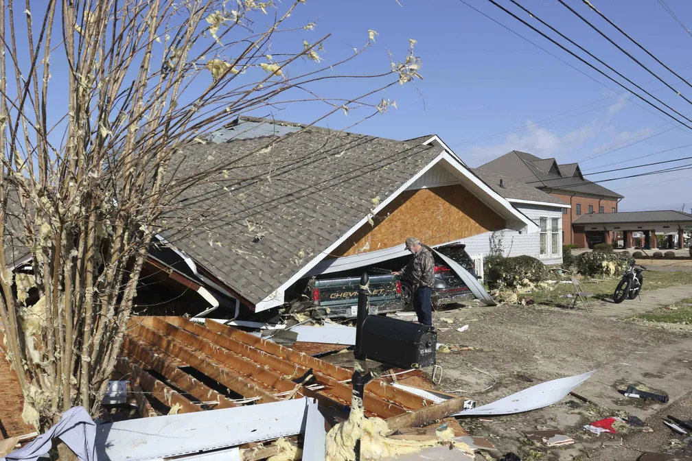
On the night of May 6, 2026, Mississippi became the backdrop for one of the most intense tornado outbreaks in the American South in recent years. It wasn’t one tornado. It was 14.
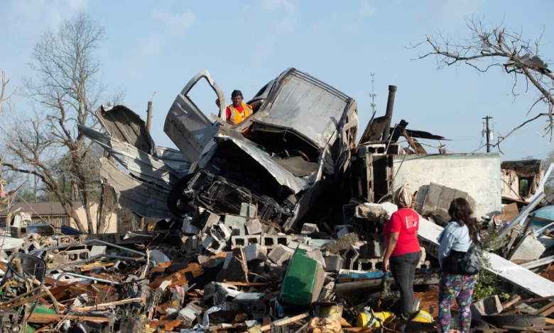
The National Weather Service confirmed over 70 miles of combined tornado track and 472 individual damage points in preliminary records alone. In practice, that means entire communities with destroyed homes, streets blocked by debris, and families who lost everything in a matter of minutes.
The Two Most Violent Tornadoes: EF3 Classification
The two most violent tornadoes received an EF3 rating — the second-highest category on the Enhanced Fujita Scale, associated with winds exceeding 136 mph (218 km/h).
- The first began in eastern Franklin County, lasted nearly 59 minutes, traveled over 35 miles with peak winds of 137 mph, and left 12 people injured.
- The second, known as the Garden City Tornado, reached winds of 136 mph and traveled over 30 miles across southern Mississippi.
But the detail that stood out most: the strongest tornado — which passed between Natchez and Brookhaven through the Homochitto National Forest — launched debris to at least 27,000 feet of altitude. That’s roughly the height of Mount Everest. Debris. In the stratosphere. That gives you the scale of what happened there.
The Hardest-Hit Counties
Lincoln and Lamar were the counties with the highest concentration of damage.
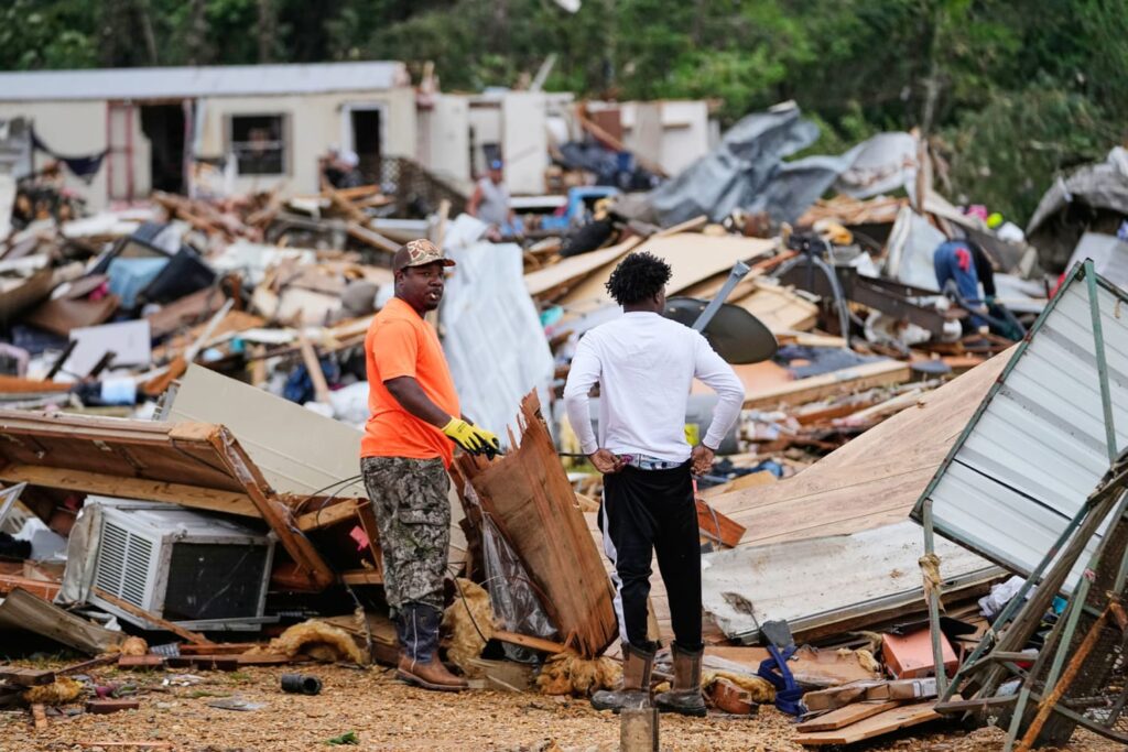
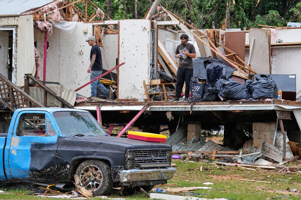
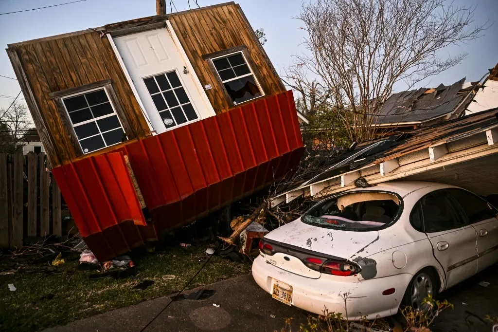
- Lamar County: approximately 275 homes hit, 50 apartment units damaged, 4 injured, and 30 roads closed due to debris.
- Lincoln County: more than 200 residences damaged and 12 people injured — most of them residents of the Wash Trailer Park in Bogue Chitto.
In total, around 400 homes were damaged across the state and at least 17 people were injured. No deaths were confirmed — which, considering the intensity of the phenomena, is almost surprising.
“We documented 78 destroyed structures and 77 with major damage. The scale of destruction across multiple counties was unlike anything we’ve seen in a single night event in years.”
— Mississippi Emergency Management Agency (MEMA)
Three Tornado Emergencies in One Night
Three Tornado Emergency alerts were issued during the night — the highest level of warning in the American system. This isn’t common. A Tornado Emergency is only declared when there’s visual confirmation of a large, destructive tornado moving toward a populated area. Three in one night, in the same state, says a lot about the intensity of the system that passed through.
The National Weather Service issued one of the alerts specifically for the cities of Bude, Meadville, McCall Creek, Brookhaven, and Bogue Chitto, after a destructive tornado was spotted near Meadville moving east at 50 mph.
The System Kept Moving
After sweeping through Mississippi, the storm system continued toward the Florida Panhandle and parts of Georgia, including the Atlanta metro area. Flash flooding was also recorded in Montgomery, Alabama, with rainfall accumulations between 4 and 6 inches.
This type of behavior — a system generating tornadoes in sequence as it moves across hundreds of miles — is characteristic of what meteorologists call a tornado outbreak. It’s not an isolated storm. It’s an organized system that keeps “planting” tornadoes along its path.
Why Is Mississippi So Vulnerable?
The state sits inside what Americans call Dixie Alley — an extension of the famous Tornado Alley that covers the southern United States. The combination of warm, moist air from the Gulf of Mexico colliding with cold air masses from Canada over the Central Plains creates ideal conditions for supercells — the storms capable of generating the most intense and long-lived tornadoes.
It’s not the first time and it won’t be the last. What changes is how prepared communities are for when it happens again.
Key Facts at a Glance
| Metric | Data |
|---|---|
| Date | May 6–7, 2026 |
| Total tornadoes confirmed | 14 |
| Strongest classification | EF3 |
| Peak wind speed | 140 mph (225 km/h) |
| Longest track | 65 miles (104 km) |
| Homes damaged | ~400+ |
| Injuries | 17 |
| Deaths | 0 confirmed |
Want to understand how EF3 tornadoes form and what sets them apart from weaker ones? Leave a comment below.
Sources: National Weather Service (NWS), Mississippi Emergency Management Agency (MEMA), AccuWeather, The Washington Post, NBC News, The Watchers