Turkey and Peru Both Hit by Earthquakes on the Same Day — What the Science Actually Shows
On May 20th, 2026, two earthquakes struck in regions that carry some of the most consequential seismic histories on Earth. A magnitude 5.6 earthquake hit Malatya, Turkey, at 9:00 AM local time. Hours earlier, a magnitude 5.8 struck the Ica region of southern Peru. This article breaks down both events and what ongoing research says about the seismic risk in each region.
What Happened in Turkey
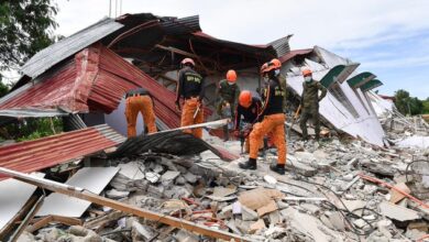
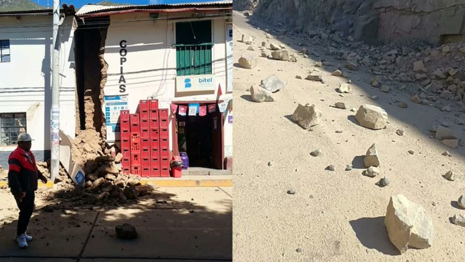
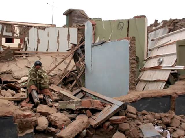
The Turkey earthquake was centered in the Battalgazi district of Malatya province, at a depth of 7 kilometers (4.3 miles), according to Turkey’s disaster management agency AFAD. The USGS registered it at M5.4 at 10 km depth. The shallow depth amplified surface shaking significantly. The tremor was felt across five provinces — Malatya, Adiyaman, Elazig, Tunceli, and Sanliurfa — reaching the Syrian border. Approximately 1.6 million people felt at least light shaking. Seventy-four people sought hospital care, most for panic-related symptoms. Schools were closed for the day. A barn partially collapsed; an abandoned building sustained structural damage. No critical injuries were reported in newly constructed buildings.
The 2023 Connection
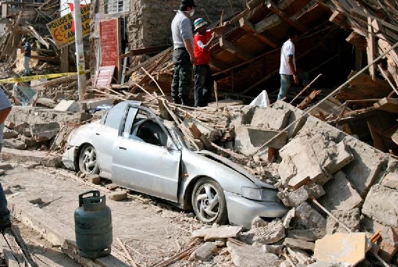
Malatya was among the provinces hardest hit by the February 6th, 2023 M7.8 and M7.6 earthquake sequence, which caused more than 55,000 people to lose their lives and inflicted over 157 billion dollars in economic damage. Since then, 124,000 earthquake-resistant housing units have been built in Malatya province alone, according to Governor Seddar Yavuz. The governor attributed the lack of structural casualties today to that reconstruction effort.
The seismological significance of today’s location is deeper than the infrastructure story. The Battalgazi district sits at the boundary of the Pütürge segment of the East Anatolian Fault Zone — a segment that received significant Coulomb stress increases from the 2023 rupture but did not itself rupture. Research published in Acta Geophysica in 2025 analyzed 14,549 earthquakes in the region and found low b-values concentrated in the Malatya-Pütürge zone, a statistical signature associated with high differential stress on a fault. The October 2024 M6.0 Kale earthquake and today’s M5.6 both occurred within this specific zone.
What Happened in Peru
The Peru earthquake struck at 5:57 PM UTC on May 19th, 2026, with its epicenter 20 kilometers east-southeast of Pampa de Tate in the Ica region. The USGS measured the depth at 56.5 kilometers (35 miles) — an intraslab earthquake, occurring within the descending Nazca Plate rather than at the interface between the Nazca and South American plates. Twenty-seven people were injured. Buildings were damaged at San Luis Gonzaga University in Ica. Peru’s Defense Minister Amadeo Flores visited the city to assess damage.
The 2007 Pisco Earthquake Parallel
The Ica region has lived through catastrophic seismic events before. On August 15th, 2007, an M8.0 earthquake near Pisco — 70 kilometers north of today’s epicenter — caused more than 500 people to lose their lives and largely destroyed the city. That event was a shallow interface earthquake, fundamentally different in mechanism from today’s intraslab event. The distinction matters for understanding long-term risk.
Intraslab vs. Interface: The Critical Difference
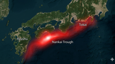
Intraslab earthquakes like today’s Peru event occur within the subducting oceanic plate as it bends under pressure. They can be damaging locally but do not release the stress that accumulates at the plate interface. Interface earthquakes, which occur at the contact zone between the subducting and overriding plates at depths of 10 to 50 kilometers, are where the truly catastrophic ruptures originate — the 1960 Chile M9.5, the 2004 Indian Ocean M9.1, the 2007 Pisco M8.0. The segment of the Nazca-South America interface offshore of Ica has not produced a major interface rupture since 2007, and the Nazca Plate continues subducting at approximately 7.7 centimeters per year.
Conclusion
Two earthquakes on the same day in two regions with documented histories of catastrophic seismic events. In Turkey, the rebuilding of Malatya appears to be working — but the fault is still loaded, and the Pütürge segment remains a focus of seismic hazard research. In Peru, today’s intraslab event reflects the constant activity of the Nazca subduction system without releasing the deeper interface stress. Both regions face ongoing baseline seismic exposure that does not diminish between events.
Sources: AFAD Turkey | USGS Earthquake Hazards Program | EMSC | European Geosciences Union EGU25-12543 (2025) | Acta Geophysica (2025) | Daily Sabah | Al-Monitor | ABC News | The Watchers